
Though it remained offshore, the storm lashed coastal areas with high winds and flooding—and produced remarkable rippling patterns in the upper atmosphere.

Hurricanes Polo and Nolo sent destructive effects ashore amid an active season in the northeastern and central Pacific.
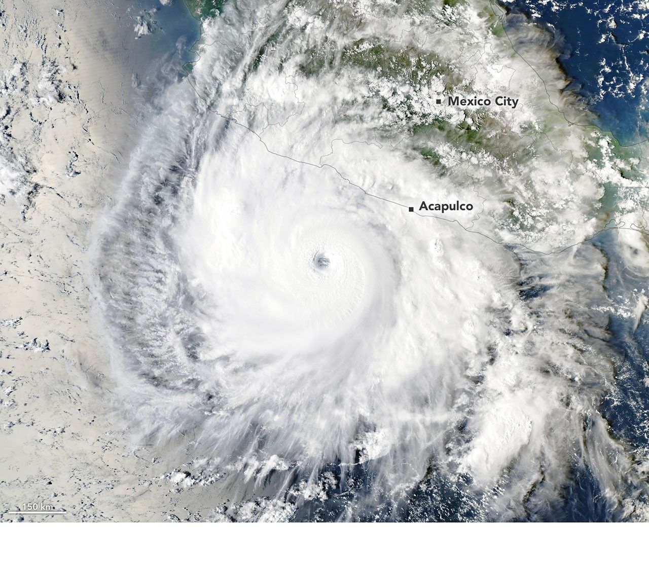
Several ingredients came together off the Pacific coast of Mexico to generate one of the strongest storms the eastern Pacific basin has ever seen.
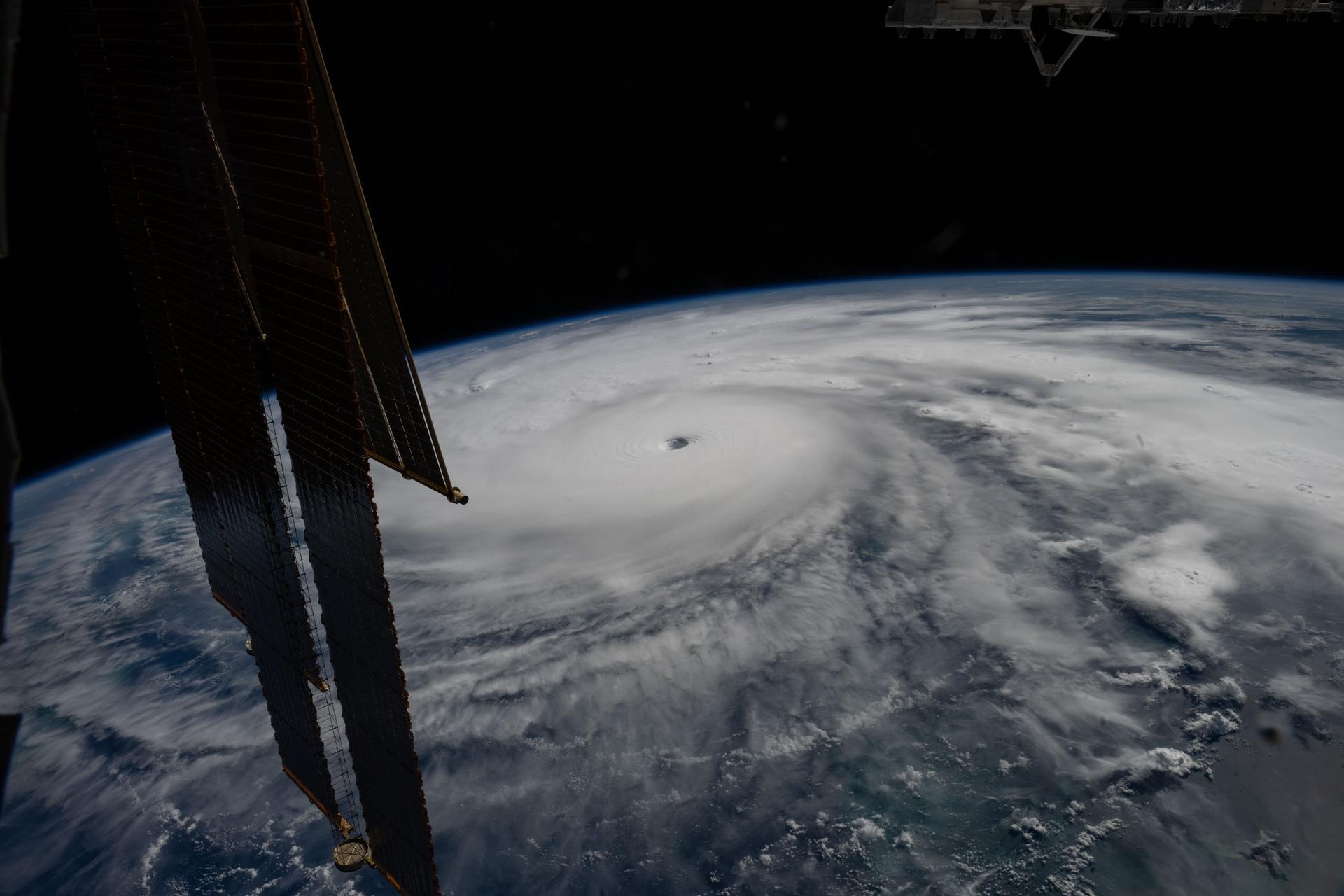
Last November, NASA and its European partners launched the Sentinel-6B satellite to improve hurricane forecasts, help protect infrastructure, and benefit commercial industries, including shipping. The satellite now is flying 30 seconds behind its predecessor, Sentinel-6 Michael Freilich. Both satellites are providing precise sea level height measurements during what oceanographers expect to be a historic El […]

The Pacific was buzzing with storms while the Atlantic was notably quiet.
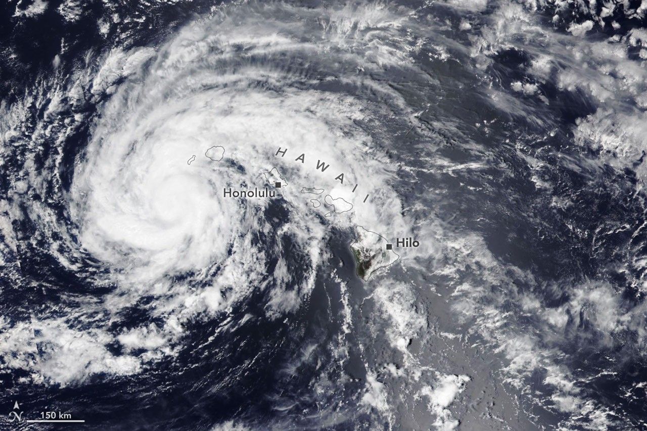
The powerful storm delivered extreme rainfall and damaging winds to the state, passing the Island of Hawaiʻi as a category 1 hurricane.

The third category 5 tropical cyclone of 2026 crossed the U.S. Northern Mariana Islands and Guam before continuing toward Asia.

The sprawling storm promised to deliver torrential rain across a wide swath of southern Japan.

Satellites observed striking upper-atmosphere phenomena generated by an intensifying tropical cyclone.

The violent storm aimed at the U.S. Northern Mariana Islands and Guam in mid-April 2026.