
Satellite records show Arctic sea ice covering less of the ocean in both winter and summer.

A new map of the terrain beneath the Greenland Ice Sheet links hundreds of valleys that previous maps missed or left fragmented.

NASA’s Earth-observing satellite missions track dozens of features of a changing planet — aerosols, sea levels, land cover, cloud cover — over years and decades. Sustaining that record for the scientific and operational communities who depend on it requires more than engineering talent. It requires planning for an uncertain future: anticipating where a mission delay […]

New animations from NASA’s PREFIRE mission reveal two years of seasonal temperature swings at the Arctic and Antarctic.

Radar data from the NISAR satellite show that La Guaira and nearby areas experienced significant ground displacement from the June 2026 temblors.

Wild disturbances are on the rise, while land disturbed by human activity has been decreasing.

Following a significant winter storm, frigid temperatures lingered in late January 2026 across a vast swath of the U.S.
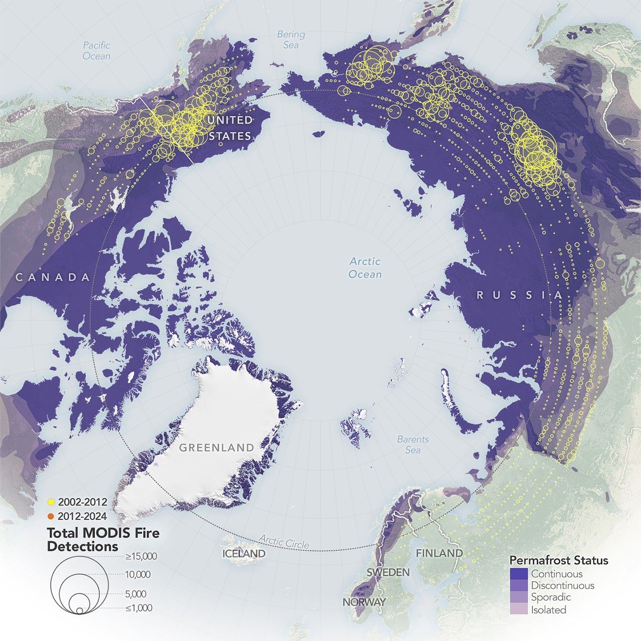
Satellite-based maps show northern wildland fires becoming more frequent and widespread as temperatures rise and lightning reaches higher latitudes.